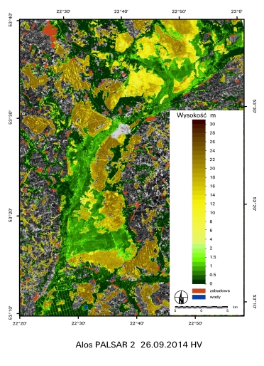
Cooperation with ESA, DLR and JAXA for purchasing microwave images
 Microwave images have been applied in IGiK since 1991 when the first ESA satellite ERS-1 was launch. That time IGiK was the only institution in Poland which used these data for research purposes. Since 1991 IGiK have received microwave images every year up to the mission ends thanks to the following projects accepted by ESA:
PP-PL3: Forest decline monitoring in ecological disaster area - Sudety Mts. case study - use of ERS-1 data;
PP-PL4: Soil moisture and evapotranspiration investigations for crop yield assessment based on ERS-1 data;
AO2.PL102: Soil moisture investigations for the different agricultural crops for biomass assessment using ERS-1 and ERS-2 data.
The images were applied to develop the methods of: forest decline monitoring in ecological disaster area; assessment of soil moisture, evapotranspiration and biomass for the different agricultural crops. Thanks to continuation of radar missions such as ERS-2.SAR i ENVISAT.ASAR as well as possibility to receive other microwave data including JERS, RADARSAT and ALOS, IGiK conducted research works in the frame of the following projects accepted by European Space Agency ESA and Japan Aerospace Exploration Agency JAXA:
- AO3-138: Use of ERS, JERS and RADARSAT SAR data for soil moisture assessment;
- AOJ-1 Use of JERS.SAR data for soil moisture estimates;
- AO.122 Assessment of the synergy of ASAR, MERIS AND AATSR data for the monitoring and management of the temperate European sensitive ecosystems. The case of the Biebrza Wetlands (Poland) and of the wetlands of the Alsacian Floodplain (France);
- CAT-1 1427 Modelling of crop-soil parameters from ENVISAT ASAR and MERIS data;
- AOALO.3677 Analysis of soil moisture and vegetation parameters from multi-frequency microwave images;
- AOALO.3742 Application of ALOS L band data for analysis of wetlands humidity and biomass assessment;
- C1P.7389 Application of remote sensing methods for the assessment of carbon balances for different biomasses and soil moistures within agriculture and wetland ecosystems;
- C1P.7847 Application of microwave images for the area flooded in May and June 2010 in Poland.
- ALOS-2 RA-4 PI No 1272 ALOS-2 PALSAR for biomass and soil moisture assessment – study for agriculture, forest and wetlands ecosystem
- ALOS-2 RA-6 PI No 3218 Assessment of soil moisture and productivity of grasslands and crops using PALSAR-2 data
Also, microwave images registered by TerraSAR-X and delivered by German Aerospace Center DLR were exploited within the framework of the projects:
- LAN0054 Detailed crop monitoring and mapping based on multi-frequency microwave images - Terra-SAR-X, were applied for the classification of crop types;
- LAN1942 Application of TerraSAR-X, Sentinel-1, and future ALOS-2.PALSAR for modelling of soil-vegetation parameters controlling carbon balance in wetlands and agriculture areas
Within these projects study on developing methods for the assessment of soil moisture and various vegetation parameters for agriculture areas have been continued and new similar investigations have been embarked at the areas of wetlands. As the results methods of the monitoring humidity and various vegetation parameters on agriculture and wetland areas have been developed as well as methods for classification of crop types.
Also, IGiK was involved in the ESA project: AO.3275 SOIL, WATER and ENERGY EXCHANGE (SWEX) Ground Based Monitoring of Soil, Water and Energy Exchange Conditions in Poland for Validation Purposes of the ESA mission SMOS as a leader responsible for the validation of soil moisture at Biebrza and Wielkopolska test sites. Also, SMOS data are used within the new ESA projects accepted in the year 2012: C1P.10669 Application of SMOS data for Biebrza Wetlands and for Wielkopolska agricultural region in Poland.


